How Drone Footage and Renderings Can Bring Development to Life

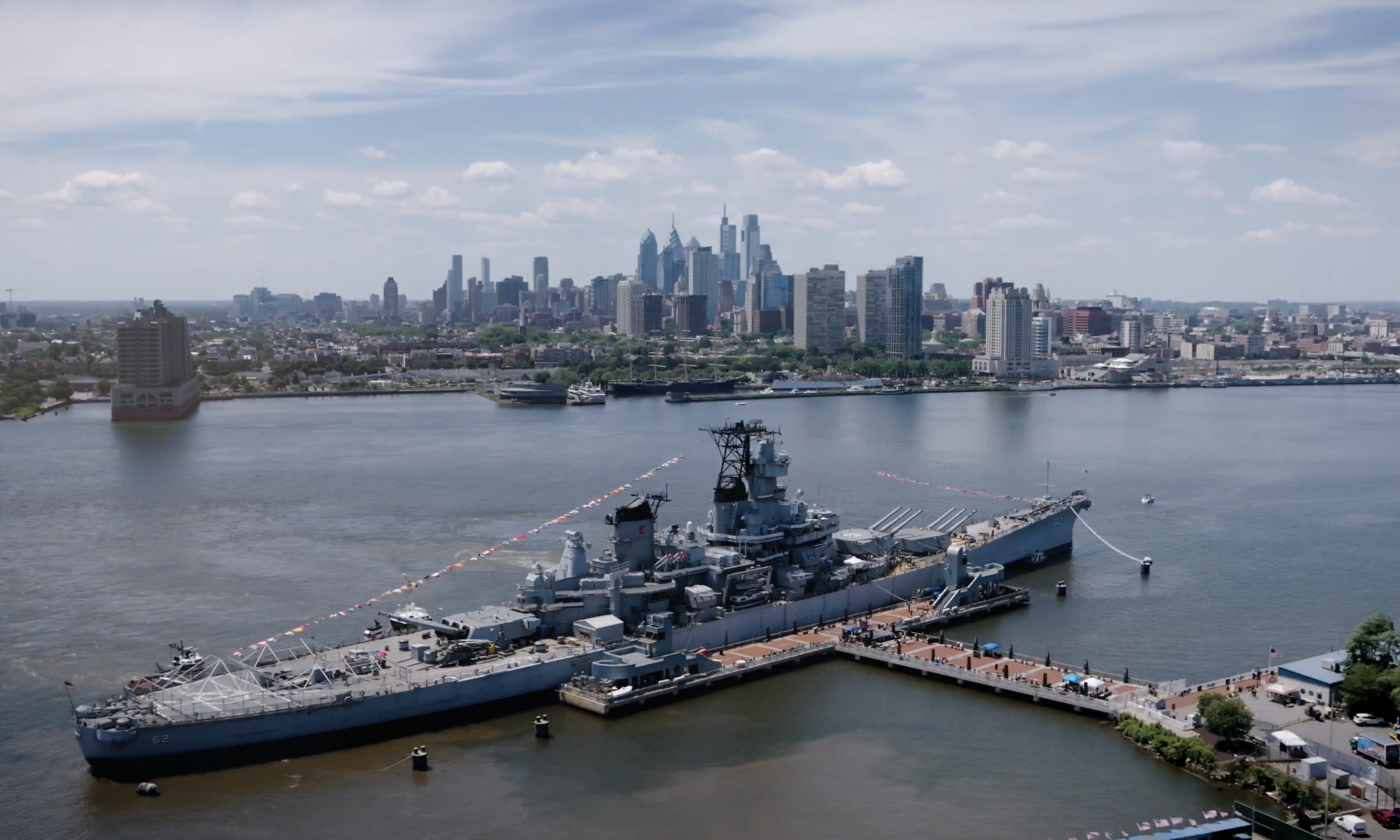
There’s a story in every construction site. Most people walk past a chain-link fence, see cranes and concrete, and have trouble picturing what comes next. Developers, architects, and leasing teams know exactly what’s coming but translating that vision to investors, future tenants, or the public is one of the most challenging parts of bringing any project to market.
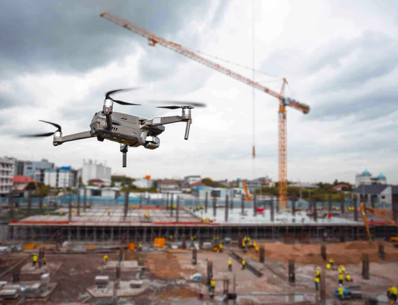
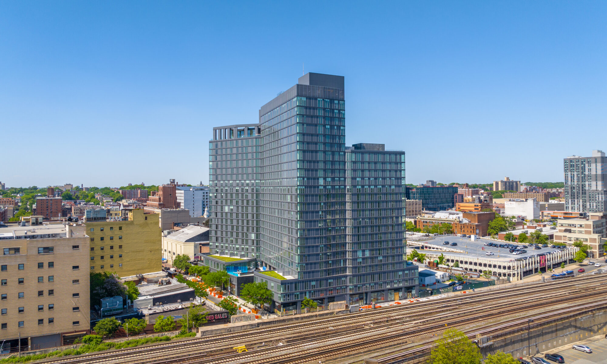
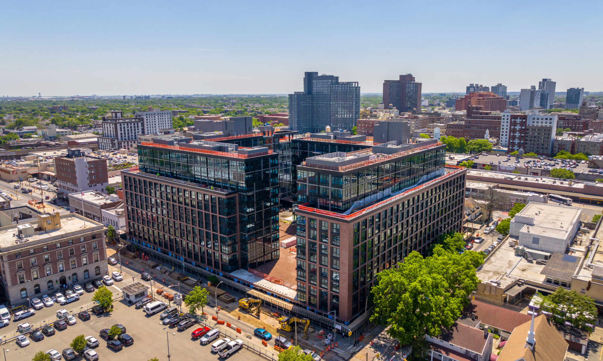
That’s where we come in. At Elevated Angles, we specialize in a type of aerial drone video work that goes beyond documentation. We film active and future construction sites and seamlessly weave that real-world footage together with architectural renderings, giving audiences an experience that bridges the gap between what exists today and what’s being built for tomorrow.

The Transition: Where Reality Meets Vision
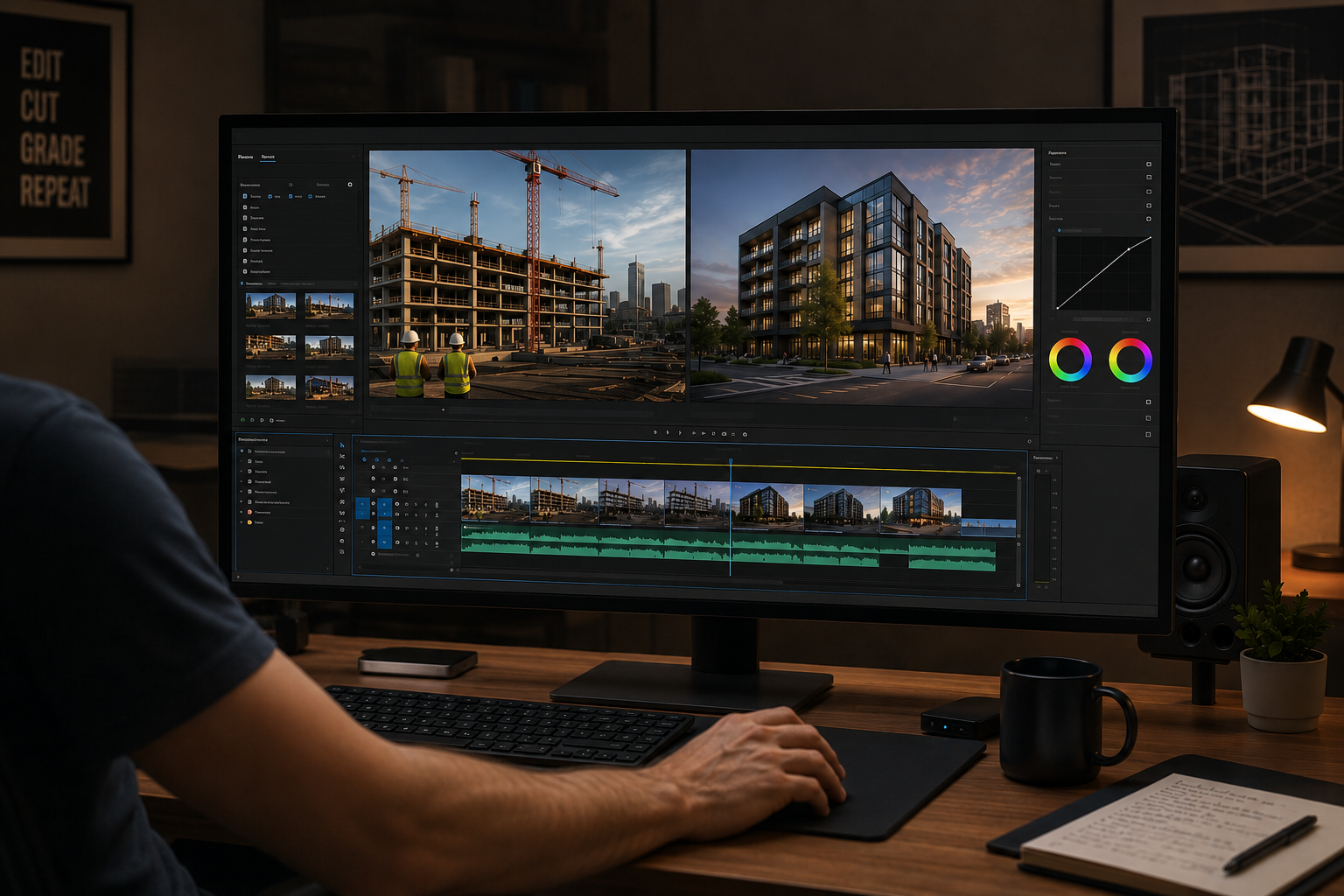
The signature technique we’ve developed is a cinematic transition from live construction footage directly into architectural renderings. In practice, this means our cameras capture the real state of a site, whether its the steel going up, the site being cleared, or the foundation being poured. Then, through precise editing, the footage dissolves into the rendering of the finished building from the exact same angle.
This allows viewers to truly see what’s coming, tying in directly to the real progress happening on the ground. It’s a storytelling device that no static rendering or standalone drone clip can replicate on its own.
Executing this kind of content requires more than just showing up with a drone. It takes careful coordination with the development team, an understanding of the architectural plans and renderings, and the ability to work safely and efficiently on or around active construction sites.

A Video Series, Not Just a Single Shoot
One of the things that sets our approach apart is how we think about this work over time. Rather than producing a single video, we partner with clients on a video series that follows a project from start to finish.
The series typically includes:
• Early-stage footage capturing groundbreaking, site preparation, and the first major structural milestones via drone footage, paired with renderings to establish the vision.
• Mid-construction updates that keep investors, stakeholders, and pre-leasing prospects engaged as the project takes shape.
• A completion video upon project delivery, acting as the capstone piece that showcases the finished development at its best, ready for leasing campaigns, investor reporting, and long-term portfolio use.
This structure gives clients ongoing content throughout a project lifecycle, not just a one-time asset.

Who This Is For: Key Use Cases

General Marketing and Brand Awareness
For developers and construction firms, this type of content establishes authority and builds brand identity in a competitive market. A well-produced video series communicates professionalism, transparency, and vision. It’s the kind of content that gets shared on social media, at industry events, in presentations and it positions your organization as one that thinks carefully about how it communicates its value.
Pre-Leasing: Residential and Commercial
Pre-leasing a building that isn’t finished yet is fundamentally a storytelling challenge. Prospective tenants, whether they’re future residents or commercial businesses evaluating a space, are being asked to commit to something they can’t yet walk through. The rendering-to-reality video format is purpose-built for this problem.
When a prospect sees actual aerial drone footage of the site today, then watches it dissolve seamlessly into the finished building they’d be signing a lease for, it bridges a gap that no brochure or static rendering can. It makes the future feel real and tangible, which is exactly what drives pre-lease conversions. For residential projects in particular, showing the surrounding neighborhood, proximity to transit, parks, and amenities from the air adds essential context that ground-level photography alone simply can’t provide.
For commercial leasing, the same content works in broker presentations, prospect meetings, and listing platforms, giving leasing teams a compelling asset that stands out from the standard floor plan and rendering package.
Portfolio Pieces for Developers and Contractors
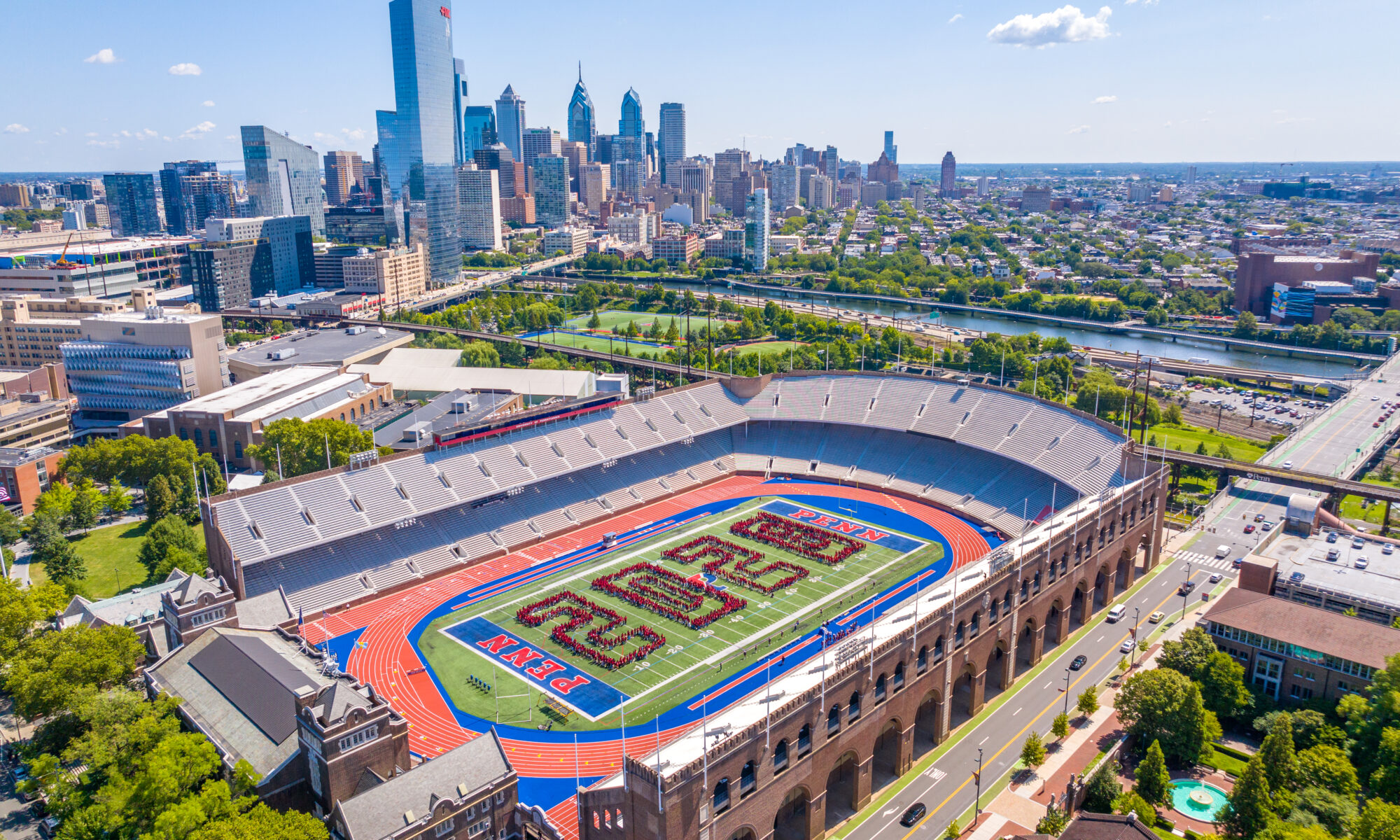
The completion video at the end of a project series isn’t just for current marketing, it becomes a permanent part of a firm’s portfolio. Whether a developer is pitching investors on their next deal, a general contractor is competing for a bid, or a design firm is presenting their body of work, high-quality aerial drone video of completed projects is among the most compelling proof of capability that exists.

Why Elevated Angles for This Work
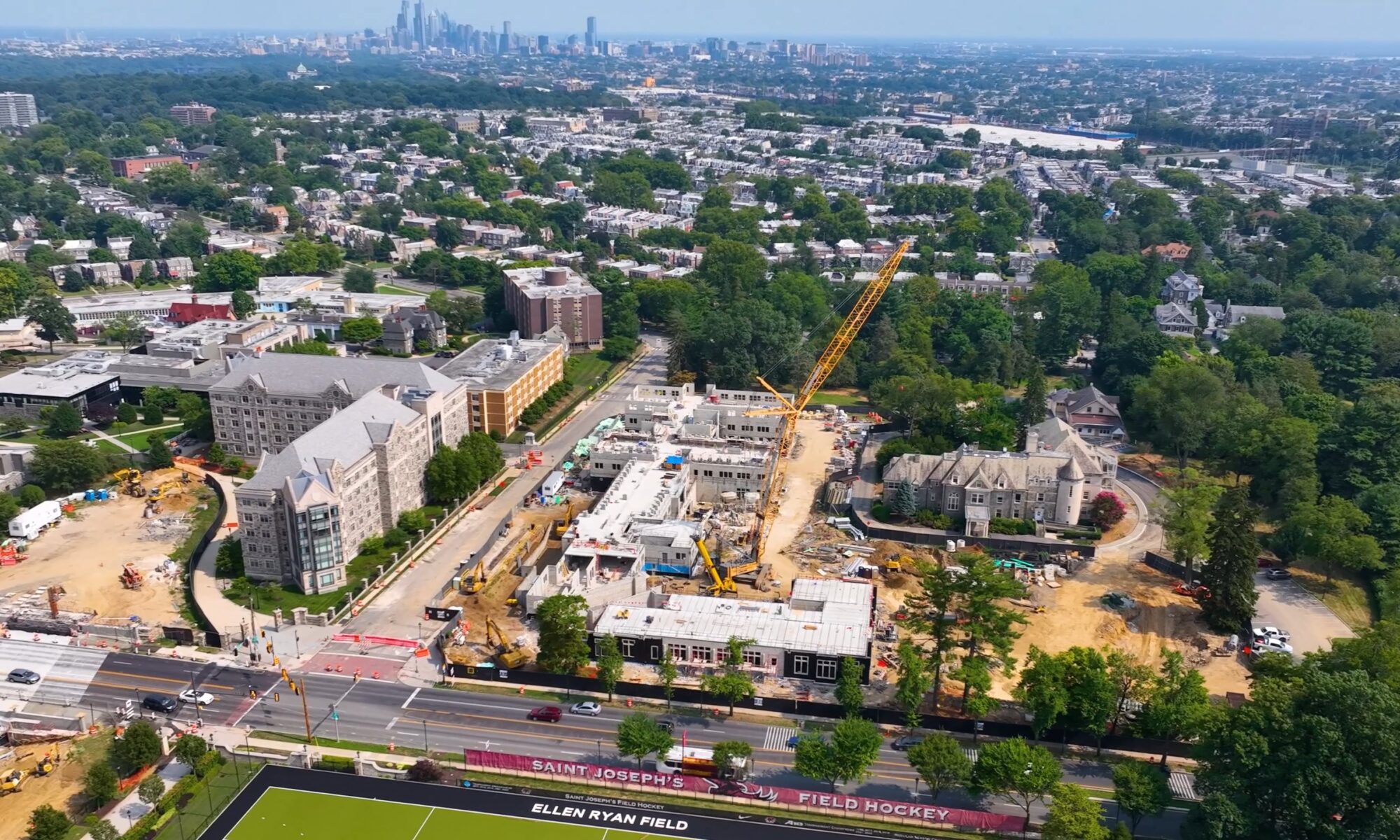
We’ve been working alongside the construction and development industry in the Greater Philadelphia region and beyond for years. Our client list includes general contractors, developers, property management companies, and architectural firms who have trusted us across multiple projects. That experience matters when it comes to this kind of work.
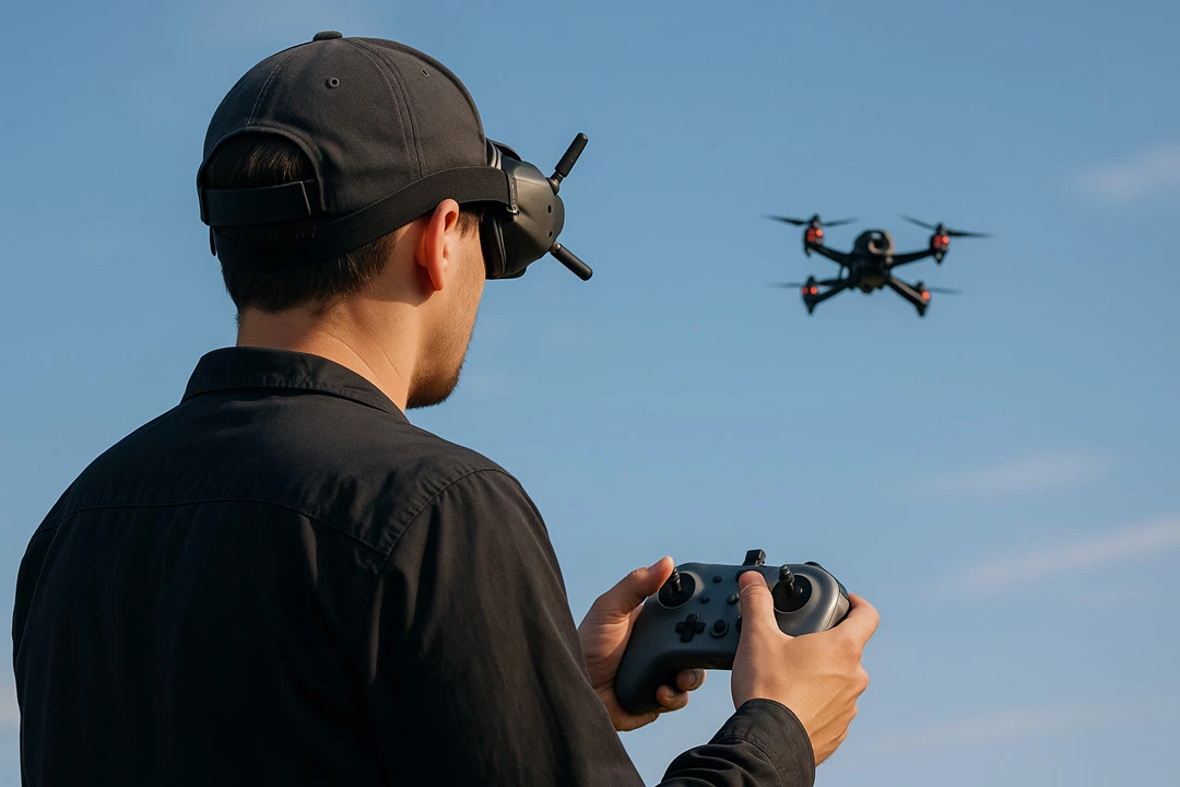
Active construction sites are dynamic, often unpredictable environments. Our team knows how to coordinate with site supervisors, work within safety protocols, and capture the footage we need without disrupting operations. Our pilots are FAA Part 107 licensed, and our aircraft are commercially insured; baseline requirements for any professional site work, and requirements that not every drone operator meets.
On the production side, the rendering integration requires a level of editorial craft that goes beyond standard aerial videography. Matching the angle, the lighting logic, and the pacing of real footage with a rendering is a skill our team has refined through repeated execution on real projects. The result is a transition that feels intentional and polished.

Let’s Tell Your Project’s Story
Whether you’re breaking ground on a new development, deep in the middle of construction, or approaching delivery of a project, there’s a version of this content that makes sense for where you are right now. We work with clients to figure out the right scope and structure for their specific situation — some projects call for a full drone video series from day one, others start with a single piece and evolve from there.

Share This Story, Choose Your Platform!

Cost vs. Benefit: Hiring a Drone Company vs. In-House Operations

At some point, most businesses that rely on aerial footage or data ask the same question: should we bring this in-house or keep working with a professional drone company? The right answer depends on your volume, budget, and how central aerial work is to your operations. This post breaks down the real costs and trade-offs of each approach to help you think it through.

What It Takes to Build an In-House Program
Building an in-house drone program involves more than purchasing equipment and hiring a pilot. Here’s what the full picture typically looks like…

Equipment
Professional-grade drone setups typically start around $5,000 and can exceed $50,000 depending on the application before accounting for batteries, backup systems, and accessories. Technology also cycles quickly so equipment that’s current today may be outdated within two years.

Licensing and Compliance
Commercial drone operations in the US require FAA Part 107 certification, airspace authorizations, and liability insurance. Local regulations and flight restrictions add further complexity. Staying current with these requirements takes ongoing attention and, if overlooked, can lead to grounded operations or fines.

Training and Personnel
Certification is a starting point, not a guarantee of quality. In practice, drone pilots are often hired early in their careers as recent graduates or entry-level professionals who see the role as a stepping stone rather than a long-term position. Once they’ve been onboarded and trained, many move on within a couple of years, and the turnover rate among in-house drone programs is high..
Getting a pilot to a point where they can consistently produce high-quality footage or reliable technical data typically takes six months to a year of dedicated training and that’s with a full-time, experienced person actively guiding them. When that pilot eventually moves on to another opportunity, the investment walks out the door with them.

Editing and Data Management
Flying the drone is only part of the job. Unless you already have a capable marketing or production team in place, you’ll also need someone who can edit photos and video, manage and organize raw data, and develop a visual style that reflects your brand consistently. That requires a different skill set entirely, one that covers creative direction, post-production software, and an understanding of how your content will be used across platforms. Finding a single person who can do both well is difficult, and splitting the role across multiple staff members adds cost and coordination overhead.

Maintenance and Downtime
Drones require regular maintenance, calibration, and occasional repairs that take equipment offline. Without backup systems, that means project delays. It’s a manageable challenge, but one worth factoring into the total cost and operational planning.

What a Professional Drone Company Brings to the Table
For organizations that don’t need aerial services on a daily basis, working with a professional drone company often makes more practical sense. Here’s why…

Editing, Post-Production, and Brand Consistency
Capturing footage is one thing, but delivering polished and on-brand content is another. At Elevated Angles, our team handles the full production pipeline: editing photos and video, managing deliverables, and developing a visual style that aligns with how you want to present your company to the world. We also understand how assets need to perform across different channels whether that’s a listing page, a social feed, or a client presentation and we produce content with that end use in mind.

Staying Current With Trends and Technology
Drone technology and content trends move fast. New aircraft, updated sensors, evolving editing techniques, and shifting platform algorithms all affect what good work looks like and how it performs. For a professional drone company, keeping up with all of it is part of the job, and we live and breathe this industry every day. For an in-house program, staying current is an ongoing time commitment on top of everything else, and falling behind can mean producing content that looks dated or using equipment that no longer meets the standard.

Expertise That Goes Beyond Flying
At Elevated Angles, our pilots bring experience across a range of environments and project types. There’s a real difference between someone who can legally operate a drone and someone who knows how to read a location, plan a flight, and deliver footage or data that’s actually useful, and that difference shows up in the final product.

The Right Tool for Every Job
Different projects call for different equipment and different expertise. Shooting for a construction company looks nothing like shooting for an architecture or development firm: the priorities are different, the style is different, and the deliverables serve entirely different purposes. A construction site update is focused on progress documentation, site coverage, and data accuracy. An architectural or development shoot is about selling a vision and it requires composition, lighting awareness, and an experienced eye. Professional drone companies understand these distinctions and bring the right aircraft, camera package, and skill set to each project accordingly:
• High-resolution cameras for real estate, marketing, and construction documentation
• FPV (First Person View) drones for dynamic, cinematic footage with fluid, immersive movement
• Thermal imaging for roof inspections, energy audits, and search operations
• Advanced software for precise topographical and construction site mapping as well as volumetric analysis

Regulatory Compliance, Built In
When you work with Elevated Angles, regulatory compliance comes built in. We hold active FAA Part 107 certifications, maintain established relationships with air traffic control and airspace authorities, and have experience navigating the waiver and authorization process for complex or restricted flight operations. That includes Low Altitude Authorization and Notification Capability (LAANC) approvals for controlled airspace, site-specific waivers for operations that fall outside standard rules, and coordination with local authorities when projects require it. We also hold standing waivers that allow us to fly Beyond Visual Line of Sight (BVLOS), fly over people and crowds, and stadium waivers for the South Philadelphia Sports Complex. We also stay current as regulations evolve to ensure your team doesn’t need to track any of it; we handle it end to end.

Flexibility and Scale
Outsourcing also means you only pay for what you use. There’s no equipment sitting idle between projects, no pilot on payroll during slower periods, and no pressure to justify aerial work just to get value out of a sunk cost.

A Note on Safety
Drones are useful precisely because they can access difficult, dangerous, or hard-to-reach places. That same capability means the stakes around safe operation are real, and professional operators approach every flight accordingly. At Elevated Angles, each job includes formal site assessment, pre-flight risk evaluation, and contingency planning before any aircraft leaves the ground.
We carry comprehensive liability coverage with a $5 million limit, structured to cover all aspects of our flight operations. That level of coverage is designed to protect our clients from exposure on every project we take on, regardless of scope or location. When you hire Elevated Angles, you’re working with a fully insured operation built to handle the real-world demands of commercial drone work.

So Which Approach Makes Sense?
For most organizations, particularly those with moderate or variable aerial needs, hiring a professional drone company tends to be the more cost-effective path. Consider a commercial real estate firm commissioning aerial shoots for six to ten properties a year: the cost of hiring a crew per project is likely a fraction of what it would take to purchase equipment, certify staff, and maintain that capability year-round.
In-house programs start to make more economic sense at high volume and high frequency like a facility with daily inspection needs. Even then, the startup cost and ongoing management are significant, and many organizations settle on a hybrid model: handling routine flights internally while outsourcing more complex or specialized work.

The Bottom Line
There’s no universal answer here it depends on how often you need aerial services, what quality you need, and what you’re willing to invest in building and maintaining an internal capability. For most businesses, the practical advantages of working with an experienced team; equipment variety, regulatory compliance, flexible scheduling, and insured operations outweigh the appeal of bringing everything in-house.
At Elevated Angles, we work with clients across real estate, construction, hospitality and entertainment, sports, and events. If you’re thinking through your aerial strategy and want to talk about what might work best for your situation, feel free to reach out.

Share This Story, Choose Your Platform!

FPV vs. Cinematic Drone: What’s the Difference?

When most people picture a drone, they imagine a smooth, sweeping aerial shot, the kind that glides over a rooftop or slowly reveals a landscape. But there’s another style of drone footage that feels completely different: fast, fluid, and immersive. These two approaches come from two very different types of aircraft, and understanding the distinction can help you figure out which one is right for your project.

FPV Drones: Flying Through the Action
FPV stands for First-Person View. The pilot wears goggles that display a live feed from the drone’s camera, so rather than watching the aircraft from the ground, they’re effectively flying from inside it. The result is highly responsive, agile flight capable of threading through narrow spaces, following fast-moving subjects, or banking through turns at speeds that a standard camera drone simply can’t match.
Unlike GPS-stabilized camera drones, most FPV drones are manually controlled and don’t self-correct. That means the pilot’s skill is everything. In the right hands, an FPV drone can produce footage that feels genuinely impossible; a single, unbroken shot that dives off a rooftop, races through a corridor, and comes out the other side into open air.

Where FPV Works Best

FPV footage is chosen when the goal is to put the viewer inside the action. Some of the most effective applications include:
• Real estate and architectural walkthroughs: Flying through rooms, hallways, and outdoor spaces in one continuous shot
• Events and live productions: Concerts, festivals, and sporting events where dynamic angles add energy
• Brand and marketing content: When a brand wants to feel bold, fast, and dynamic
The trade-off is that FPV footage has a distinctive look; slightly wide, slightly raw, with motion that can feel intense. That’s often exactly what clients want. But for projects that call for calm, polished visuals, a different tool is often a better fit.

Why FPV Services Cost More

FAA-Required Two-Person Crew
Under FAA regulations, FPV operations legally require a second crew member on site: a dedicated Visual Observer. Because the FPV pilot is flying with goggles on and focused entirely on the camera feed, the Visual Observer is responsible for maintaining line-of-sight awareness of the aircraft, monitoring airspace, and keeping the operation safe. This isn’t optional, it’s a regulatory requirement. Every FPV shoot involves at minimum two trained professionals, which is reflected in the cost.

A Higher Skill Ceiling
Both types of drone work require skilled pilots, but cinematic drones are built with a safety net: GPS stabilization, obstacle sensing, and automated flight modes all help keep the aircraft on a predictable path. FPV drones have none of that. Every movement is manual, every shot depends entirely on the pilot’s hands and judgment. The level of precision required to execute clean, usable FPV footage especially in tight spaces or around people takes years of deliberate practice to develop.
It’s also worth noting that most cinematic drones while producing excellent broadcast-quality footage, operate within a fairly defined range of capabilities. The exception is something like the DJI Inspire 3, a professional cinema-grade platform that commands its own significant price premium and occupies a different tier entirely. For most commercial and marketing work, standard cinematic drones deliver outstanding results at a more accessible rate. FPV, by contrast, is priced where it is because of what it genuinely takes to do it well.

Cinematic Drones: Smooth, Deliberate, and Film-Quality

A cinematic drone is built around one priority: image quality. These aircrafts carry high-resolution cameras, usually shooting 4K, 6K, or higher and mounted on a 3-axis gimbal that keeps the frame perfectly level regardless of how the drone moves. GPS stabilization adds another layer of control, making it possible to hold a precise position or execute slow, smooth movements even in light wind.
The footage they produce looks and feels intentional. Movement is slow and considered such as a gentle push toward a subject, a wide orbit around a building, a rising reveal over a tree line. The cameras shoot in log color profiles that preserve detail in highlights and shadows, giving editors room to color grade the footage to a professional finish.

Where Cinematic Drones Work Best

Cinematic drones are the standard choice for any project where presentation and visual quality are the priority:
• Commercial real estate and property marketing: Smooth aerials that show off a building, its surroundings, and the neighborhood
• Construction documentation: Clean, consistent overhead and orbital shots for progress tracking and stakeholder updates
• Travel and tourism content: Landscapes, coastlines, and landmarks captured with the kind of scale and mood that stills can’t convey
• Film and documentary work: Wherever broadcast-quality footage is required

So Which One Do You Need?

The simplest way to think about it: if you want the viewer to feel like they’re moving through a space, FPV is usually the right call. If you want them to stop and take in a scene, cinematic is the better fit.
That said, the two aren’t mutually exclusive. Some of the most effective projects use both, with cinematic aerials to establish context and scale, with FPV sequences woven in to add energy or tell a story from ground level. The right mix depends on the tone you’re going for and what you want the audience to feel.
At Elevated Angles, we operate both types of aircraft and work with clients to figure out which approach or which combination best serves the project. If you’re not sure where to start, we’re happy to talk it through!

Share This Story, Choose Your Platform!

How Automated Drone Docks Are Transforming the Construction Industry

The construction industry is in the middle of a massive shift—one driven by automation, data, and real-time visibility. And at the center of that transformation is a technology that once sounded futuristic: the autonomous drone dock.

A drone dock is a self-contained, automated base station that stores, charges, protects, and launches a drone without the need for a pilot on-site. These stations offer weather-protected housing, rapid charging, remote management, automatic cloud uploads, and mission scheduling.

Drone docks are automated mini-hangars that allow a drone to live on the jobsite full-time and run missions without a pilot on-site. They combine rugged hardware, smart software, and FAA-approved remote operations to create a fully autonomous drone workflow.
Founder & CEO of Elevated Angles, Brett Tiagwad comments, “drone docks at construction sites are revolutionizing how owners, developers and general contractors document and manage a construction project.”

How They Work:

1. The Dock: A Smart, Self-Managing Base Station
– Automated charging (10–90% in ~32 minutes)
– Weather protection against rain, wind, dust, and temperature
– Diagnostics and firmware syncing
– Secure data upload to cloud platforms

2. Remote Flight Control From Anywhere
Certified Part 107 pilots supervise missions remotely, planning flights, monitoring telemetry, and reviewing imagery.

3. Pre-Programmed, FAA-Compliant Flight Paths
Repeatable missions include GPS waypoints, altitudes, camera angles, and obstacle clearance. The system adapts to cranes, materials, and structural changes.

4. Automated Takeoff Checks
Before each launch, the dock checks weather, battery health, GPS, and sensors.

5. Autonomous Flight With Real-Time Monitoring
The drone flies its route automatically while the pilot monitors telemetry and battery levels.

6. Return, Recharge, and Upload
After the mission, the drone returns to the dock, recharges, and uploads all data.

7. Continuous Construction Intelligence
Cloud processing delivers progress logs, earthwork analyses, material verification, 2D/3D models, safety documentation, and more.

8. FAA Waivers Make This Possible
Beyond Visual Line Of Sight and Flight Over People waivers enable safe, legal autonomous operations on active construction sites.

FAA Regulations: The Key That Unlocks Drone Dock Automation

1. Beyond Visual Line of Sight (BVLOS) Waiver
Standard FAA rules require pilots to keep drones in sight. Drone docks rely on BVLOS waivers to operate autonomously with remote oversight.

2. Flight Over People (FOP) Waiver
Construction environments are populated and dynamic. This waiver permits operations in areas with workers or bystanders, unlocking true on-site automation.

3. Airspace Compliance and Site Approvals
Before installation, teams assess power, connectivity, and airspace constraints to ensure full regulatory compliance.

Why Construction Companies Are Adopting Drone Docks Quickly

– Daily autonomous progress documentation
– On-demand remote visibility for owners and PMs
– Earthwork tracking and subcontractor accountability
– Material delivery verification and theft deterrence
– Enhanced safety and compliance documentation
– High-quality marketing and reporting visuals

Autonomous drone docks replace occasional site photos with continuous, automated intelligence—captured safely, consistently, and without human risk.

Share This Story, Choose Your Platform!

A Day in the Life of a Drone Operator

A Day in the Life of a Drone Operator

At Elevated Angles, no two days are ever the same—and that’s exactly how we like it.

As a drone operator, we get to see the world from a perspective most people never experience. Whether we’re flying through tight interior corridors, capturing a construction site from 400 feet in the air, or weaving around buildings downtown to grab that perfect cinematic shot, each day is its own unique mission.

So what does a typical day look like for us? Here’s a peek behind the propellers.

6:30 AM – Pre-Flight Prep

Early mornings are common—golden hour doesn’t wait for anyone. Before heading out, we check the forecast, confirm airspace regulations and flight permissions, and make sure all gear is prepped: batteries charged, props inspected, SD cards formatted, and backups packed. When you’re flying drones in complex environments, preparation is everything.

8:00 AM – On Location

We arrive on-site early to scout the area. Even if we’ve flown there before, conditions can change—new obstacles, construction, or lighting situations. We walk the site, plan our flight paths, and coordinate with the client or production crew. Safety is always our top priority.

9:00 AM – First Takeoff

Once everything’s locked in, it’s time to fly. Depending on the project, we might be using a high-end cinematic drone for smooth, sweeping shots or an FPV drone for fast-paced, dynamic footage. This is where the magic happens—and where all the planning pays off.

11:00 AM – Midday Adjustments

Drone work is highly technical, but it’s also deeply creative. We review what we’ve captured, identify gaps, and pivot if needed. Some shots may need to be refilmed to match the light, or we’ll change lenses to highlight a specific detail. It’s a mix of engineering and artistry.

1:00 PM – Wrap & Packup

Once we’ve captured everything we need, we pack up gear and pack up footage on multiple drives—on-site and in the cloud. Redundancy is key. From there, we head back to HQ or the next location.

3:00 PM – Post-Production Handoff

Back at headquarters footage gets logged, organized, and passed off to our editing team (or we dive into editing ourselves, depending on the scope). Each shot is color corrected, stabilized, and brought to life in the context of a larger story.

4:00 PM – Planning the Next Mission

With one project down, we shift gears to prep for the next. That might mean submitting FAA flight waiver requests, coordinating with property managers, or reviewing creative briefs with a client. It’s a fast-moving process—and that’s part of the fun. Oh, and if there’s a good pizza spot nearby, you can bet we’ll find it.

Being a drone operator is about more than flying a cool piece of tech. It’s about telling stories, solving problems, and bringing a vision to life—safely, skillfully, and creatively.

At Elevated Angles, we don’t just fly drones. We capture perspectives that elevate everything around them.

Share This Story, Choose Your Platform!

Where Passion Meets Purpose: The Elevated Angles Story

Where Passion Meets Purpose: The Elevated Angles Story

Elevated Angles LLC is a premier aerial photography and videography company based in Philadelphia, Pennsylvania. Founded in 2017 by Brett Tiagwad, the company specializes in capturing captivating aerial imagery using advanced drone technology. Their services cater to a diverse range of industries, including construction, real estate, insurance, and special events.

A Vision Born from Adversity

The inception of Elevated Angles is rooted in Brett Tiagwad’s personal journey of recovery from addiction. Discovering the therapeutic benefits of drone flying, Tiagwad transformed his newfound passion into a thriving business. Today, Elevated Angles not only delivers exceptional aerial content but also commits to social responsibility by donating 5% of its annual revenue to Caron Treatment Centers, supporting addiction treatment initiatives.

Comprehensive Drone Services

Elevated Angles offers a wide array of drone services, including:

Aerial Photography and Videography: Capturing high-resolution images and 8K videos from unique perspectives.

Video Production and Editing: Providing professional, cutting edge post-production services to create compelling visual narratives.

Live TV Broadcast: Offering live aerial coverage for events and broadcasts.

Mapping Technology: Utilizing drones for accurate mapping and surveying.

Inspections and Claim Footage: Conducting safe and efficient inspections for insurance claims.

Social Media Management: Creating engaging content tailored for each platform, with strategies rooted in current trends and a deep understanding of platform-specific best practices.

360° Panoramas and Virtual Tours: Developing immersive experiences for real estate and tourism.

Construction Timelapse: Capturing construction progress through a combination of ground footage and one-of-a-kind aerial timelapse videos that showcase the full scope of the build.

Thermal Imaging: Detecting heat signatures for various applications.

Serving Diverse Industries

Elevated Angles collaborates with clients across multiple sectors:

Construction: Partnering with developers and contractors to monitor project progress.

Real Estate: Enhancing property listings with captivating aerial visuals.

Insurance: Providing detailed inspections to streamline claim processes.

Special Events: From the Eagles Super Bowl Parade to private events and major productions, EA captures unforgettable moments from the ground and sky. Our work spans weddings, brand activations, and TV sets—including projects with Pel Productions, Bowstring, Dope Thief, Long Bright River, and more.

Client Testimonials

Clients have praised Elevated Angles for their professionalism and quality of work:

“We contracted with Elevated Angles to take drone photos of all Meridian Bank branches… Our contract was completed on time and on budget, and our board and senior management have been thrilled with the creative, unique drone photos we now regularly use in Meridian’s marketing efforts.”
— Jessica Annas, SVP, Marketing, Meridian Bank

“Elevated Angles has produced remarkable content for us at both our Pennsylvania and Florida campuses. We have been thrilled with the quality of the work, the timeliness of the deliverables and the creativity that EA brings to the table.”
— Sean Lavelle, EVP / Chief Development Officer, Caron Treatment Centers

Connect with Elevated Angles:

To learn more about Elevated Angles and explore their portfolio, visit their official website: www.elevatedangles.com. For inquiries or to book their services, contact them at info@elevatedangles.com or call 609-870-6828.Elevated Angles LLC

Elevated Angles continues to redefine aerial storytelling, delivering unparalleled perspectives that captivate and inspire.

Share This Story, Choose Your Platform!

New Perspective on Insurance Claims

A New Perspective on Insurance Claims: How Drones Are Transforming the Industry

Insurance claims have traditionally relied on manual inspections, paperwork, and lengthy processing times. But with advancements in drone technology, insurance companies now have a powerful tool to streamline assessments, enhance accuracy, and improve overall efficiency. At Elevated Angles, we specialize in high-quality aerial footage and inspections, helping insurers and adjusters get a clearer picture—faster and safer than ever before.

The Challenges of Traditional Insurance Inspections

Whether assessing property damage from a storm, fire, or structural failure, traditional claims inspections often face several challenges:

Safety Risks – Inspecting rooftops, unstable structures, or disaster zones can pose significant hazards for adjusters.
Time-Consuming Processes – Manual evaluations require travel, on-site inspections, and extensive documentation, leading to delays in claim resolution.
Limited Access – Some areas are difficult to reach, resulting in incomplete assessments that may lead to disputes or inaccurate claims.

How Drones Are Revolutionizing Insurance Claims

Drones offer a game-changing solution for insurers, allowing for faster, safer, and more detailed assessments. Here’s how they are transforming the claims process:

1. Enhanced Safety & Risk ReductionDrones eliminate the need for inspectors to climb unstable structures or enter hazardous areas. With high-resolution cameras and thermal imaging capabilities, adjusters can capture critical data from a safe distance.
2. Faster Claim ProcessingAerial inspections dramatically reduce the time it takes to document damage. Instead of waiting for manual inspections, insurers can receive instant visual data, expediting claim approvals and payouts for policyholders.
3. High-Resolution Imaging & AccuracyDrones provide detailed imagery, capturing damages that might be missed in a ground inspection. This improves claim accuracy, reducing disputes and ensuring policyholders receive fair settlements.
4. Cost Savings for Insurance CompaniesBy streamlining the inspection process, drones reduce labor costs and minimize the need for extensive manual evaluations. Insurers can allocate resources more efficiently while still maintaining thorough assessments.
5. Improved Documentation & ComplianceDrone footage and 3D mapping create comprehensive records that support claims documentation. This ensures transparency, reduces fraud, and enhances compliance with regulatory requirements.

Applications of Drones in InsuranceDrones are revolutionizing various sectors of insurance, including:
Property Damage Claims – Quickly assess storm, fire, or flood damage to homes and commercial properties.
Disaster Response – Evaluate large-scale damage after hurricanes, wildfires, or earthquakes to prioritize claims efficiently.
Roof Inspections – Capture high-resolution images of roofing conditions without the need for ladders or scaffolding.
Agricultural Assessments – Assess crop damage from natural disasters and pests with aerial imagery

Elevate Your Claims Process with Drone Technology

At Elevated Angles, we provide high-quality drone services tailored to the insurance industry. Our team of FAA-certified pilots ensures precise data collection, delivering reliable aerial imagery that accelerates the claims process.
By integrating drone technology, insurance companies can not only improve efficiency but also enhance customer satisfaction with faster claim resolutions.

Ready to take your claims processing to new heights? Contact Elevated Angles today to see how drone technology can revolutionize your insurance assessments.

Share This Story, Choose Your Platform!

Navigating Drone Safety and Regulations

Navigating Drone Safety and Regulations: What Every Aerial Creator Needs to Know

Drones have revolutionized the way we capture video and photography, offering breathtaking perspectives that were once impossible to achieve. At Elevated Angles, we specialize in high-quality drone cinematography for commercial projects, concerts, real estate, and beyond. However, with great aerial capabilities comes the responsibility of understanding and adhering to drone safety and regulations.

Understanding FAA Drone Regulations

In the U.S., the Federal Aviation Administration (FAA) governs drone operations, and all commercial drone pilots must comply with Part 107 regulations. These rules include:

  • Pilot Certification – Commercial operators must obtain a Remote Pilot Certificate by passing the Part 107 knowledge test.1
  • Flight Restrictions – Drones cannot exceed an altitude of 400 feet above ground level unless flying within 400 feet of a structure
  • Airspace Authorization – Flying in controlled airspace (such as near airports) requires obtaining LAANC (Low Altitude Authorization and Notification Capability) approval.
  • Daylight Operations – Without a waiver, drones must be flown during daylight or twilight hours with anti-collision lights.
  • Line of Sight – The drone must remain within the visual line of sight of the pilot or an observer at all times.
  • Prohibited Areas – Certain areas, including military bases and national parks, are off-limits without special authorization.

Safety Best Practices for Professional Drone Operators

Beyond regulations, ensuring safe drone operations requires best practices that protect both the equipment and the environment. Here are a few key steps we follow at Elevated Angles:
1. Pre-Flight PlanningEvery shoot starts with meticulous planning. We research airspace restrictions, check weather conditions, and review site-specific hazards. Using tools like FAA’s B4UFLY app and sectional charts, we determine whether special permissions are needed.
2. Equipment InspectionsDrones must be in top condition before every flight. We perform routine maintenance, checking batteries, propellers, and firmware updates to ensure safe and reliable operation.
3. Risk Management on SetWhen capturing dynamic footage for events, real estate, or creative projects, we assess potential risks, establish safety perimeters, and communicate with ground crews. Having a visual observer and a backup landing zone ensures smooth operations.
4. Public Awareness & PrivacyDrones often draw attention. We prioritize transparency and respect privacy by informing nearby individuals about our filming, avoiding sensitive locations, and following local laws regarding surveillance.

Staying Ahead of Regulatory Changes

The drone industry evolves rapidly, and staying informed about regulation updates is crucial. Whether it’s upcoming Remote ID requirements or changes in waivers for night operations, we continuously educate ourselves to ensure compliance.
For businesses and creatives looking to integrate drones into their projects, understanding and following regulations is key to maintaining both safety and professionalism. At Elevated Angles, we blend expertise with compliance, ensuring every flight meets the highest industry standards while delivering stunning visual content.

Need expert drone cinematography for your next project? Contact Elevated Angles today to bring your vision to life—safely and legally.

Share This Story, Choose Your Platform!

A New Way to Capture Every Construction Milestone

A New Way to Capture Every Construction Milestone

When it comes to managing construction projects, staying on top of progress is crucial. One of the most innovative and efficient ways to do this is by utilizing drone technology. At Elevated Angles, we specialize in capturing monthly progress through aerial footage, offering a detailed, real-time view of construction sites. This allows project managers, stakeholders, and clients to monitor every phase of development, from the ground-breaking to the final stages of completion.

The Benefits of Drone Monitoring for Construction Sites

Traditional methods of tracking construction progress often rely on manual inspections or static ground-level photos, which only provide a limited view of the project. Drones, however, bring a fresh perspective and offer several advantages that make them ideal for capturing construction progress:

Comprehensive Site Coverage: Drones can fly over and around the entire site, providing a complete view of the project’s progress. This allows for detailed visual documentation of each area, from foundations and framework to roofing and landscaping.
High-Resolution Imagery: Equipped with high-definition cameras, drones can capture clear and detailed images from every angle. This ensures that even the smallest developments are documented, allowing project managers to make more informed decisions.
Time and Cost Savings: Drones can cover a large site in a fraction of the time it would take for a manual inspection. This reduces the need for on-site visits and helps identify potential issues early, preventing costly delays.
Progress Tracking Made Simple: Regular drone flights can capture changes on-site each month, providing a consistent record of progress. This is especially valuable for tracking how construction evolves over time and keeping clients and investors updated on key milestones.

Creating Stunning Timelapses with Drone Footage

One of the most impactful ways drones can enhance a construction project is by creating a timelapse video. By capturing monthly aerial footage, we can compile a visual narrative that shows the project from start to finish. Here’s how timelapse footage can benefit construction teams and stakeholders:
Visualizing the Entire Journey: Timelapse videos allow viewers to see how a building or development takes shape over time. From the initial groundwork to the completion of the structure, every stage of construction is seamlessly captured and displayed in an engaging, condensed format.
Powerful Marketing and Presentation Tools: For contractors, developers, or architects, timelapse videos serve as a valuable marketing tool. They showcase the project’s complexity and craftsmanship, offering a compelling way to present the finished product to clients, investors, or future customers.
Enhanced Reporting and Documentation: A timelapse isn’t just a marketing asset—it’s also a practical tool for project managers. By reviewing the footage, teams can ensure that the construction is staying on schedule, and they can pinpoint any potential delays or challenges as they arise.

Why Choose Elevated Angles for Construction Progress Monitoring?

At Elevated Angles, we understand the importance of delivering reliable, high-quality footage that meets the needs of construction teams. Here’s why our drone services stand out:
Tailored Flight Schedules: We work with your project timeline to schedule monthly or even weekly drone flights that capture the most critical phases of construction. Our regular monitoring ensures that every important milestone is documented.
Expert FAA-Certified Pilots: Safety and precision are our top priorities. Our pilots are fully FAA-certified and experienced in navigating complex construction sites to capture the footage you need without interrupting daily operations.
Seamless Video Editing: Our in-house editing team can turn your footage into a polished timelapse video that highlights the entire construction process. We deliver videos that are ready for presentations, marketing, or internal review.
Customized Solutions: Every construction project is unique, and so are our solutions. Whether you’re building a single structure or managing a multi-phase development, we adapt our services to meet your specific needs and deliver consistent, valuable content.

Experience the Future of Construction Monitoring Today

Take your project management to new heights with Elevated Angles’ drone technology. Don’t just watch your project grow—ensure it flourishes with precise, efficient, and stunning aerial documentation. Ready to see the difference? Contact us now for a free demonstration or to discuss your project’s specific needs. Elevate your construction monitoring with just one call or click.

Share This Story, Choose Your Platform!

University Campuses Reimagined: Drone Perspectives of Higher Education

University Campuses Reimagined: Drone Perspectives of Higher Education

As universities continue to evolve, so do the ways they are documented and experienced. At Elevated Angles, we believe in showcasing the unique energy and beauty of university campuses like never before—through the lens of cutting-edge drone technology. Whether it’s capturing vibrant student life, sprawling academic buildings, or iconic landmarks, our team specializes in delivering breathtaking aerial imagery that brings campuses to life.

Why Drone Footage for Universities?

Universities are more than just buildings; they are vibrant ecosystems brimming with history, culture, and innovation. Drone photography and videography allow us to show the full scope of a campus’s design, layout, and the energy that pulses through its grounds in a way that traditional methods simply can’t. Here’s why drone footage is a game-changer for university marketing, recruitment, and alumni engagement:
Bird’s-Eye View: Capture the full scale and beauty of campus landscapes, showcasing everything from lush green spaces to state-of-the-art facilities.
Highlight Key Features: Whether it’s an iconic bell tower, historical building, or state-of-the-art lab, drones can emphasize key features that define a campus.
Immersive Storytelling: From freshmen orientation to class reunions, drone footage allows us to tell stories that resonate with students, staff, and alumni alike.

Case Studies: University Class Photos From Above

We recently had the privilege of working with two prestigious institutions—the University of Pennsylvania and West Chester University of Pennsylvania—on class photo projects. These projects not only showcased the scale and grandeur of these universities but also brought a new level of creativity and precision to traditional class photos.

Navigating FAA Waivers for the University of Pennsylvania

Flying a drone in an urban setting like Philadelphia presents unique challenges, particularly near a major institution like the University of Pennsylvania. To ensure compliance with FAA regulations, we secured a special waiver for this project. This process required a thorough understanding of flight regulations, risk mitigation, and advanced coordination with both the FAA and local authorities. Our expertise and experience allowed us to navigate these complexities smoothly, reinforcing our reputation as industry leaders in aerial drone operations. The result was a stunning aerial shot of the entire graduating class on a historic campus lawn, framed by the university’s iconic architecture.

Capturing the Sunset for West Chester University

At West Chester University, the client envisioned a sunset class photo that required meticulous planning to make the most of the fleeting golden hour. To achieve this, we deployed a three-person crew to maximize efficiency and capture multiple angles in the limited timeframe. With careful coordination and precise timing, we delivered vibrant, cohesive images that truly encapsulated the unity and spirit of the graduating class.

Why Elevated Angles for University Drone Projects?

Our work with universities showcases our ability to blend creativity with technical expertise. Here are a few reasons why partnering with Elevated Angles ensures your campus drone projects are a success:
FAA-Certified Pilots: Safety and regulation compliance are always our top priorities. We handle the permits, waivers, and flight path planning so you can focus on the vision.
Advanced Equipment: Our drones are equipped with high-definition cameras, ensuring your footage is crisp, clear, and ready for use across various media platforms.
Customized Solutions: Whether it’s a one-time event like a class photo or ongoing campus tours for prospective students, we tailor our services to meet your needs.
Seamless Editing and Delivery: Our in-house editing team ensures your footage is polished and ready for promotional use, delivering stunning visuals that tell your campus story.

Let’s Showcase Your University

Drone photography and videography bring a fresh, elevated perspective to university campuses. Whether you’re looking to highlight your campus in recruitment materials, document a special event, or create a unique class photo like those at the University of Pennsylvania and West Chester University of Pennsylvania, Elevated Angles has the expertise to deliver stunning, dynamic footage.
Contact us today to explore how we can help bring your university campus to life from above.

Share This Story, Choose Your Platform!

An Inside Look On Filming the Battleship New Jersey’s Historic Move

Filming the Battleship New Jersey’s Historic Move: An Inside Look with Elevated Angles

At Elevated Angles, we pride ourselves on being at the forefront of the drone industry, providing unparalleled aerial footage that brings the unimaginable to live. One of our most exciting projects to date was filming the Battleship New Jersey as it moved from the drydock at the Naval yard in Philadelphia to Paulsboro New Jersey then back to Camden New Jersey. This was not just any shoot—it was a complex, multi-faceted project that demanded meticulous planning, expert execution, and a deep understanding of both drone technology and FAA regulations. Here’s a behind-the-scenes look at how we brought this iconic moment to life.

The Discovery Call: Setting the Stage for Success

The discovery call marks the beginning of our project process and often stems from the impact our previous work has made. In this case, the client reached out to us after witnessing our FPV drone in action while filming the Battleship leaving Camden for the Navy Yard. Among all the drones in the sky that day, our FPV drone stood out, capturing the client’s attention even before they saw the final footage. Once they viewed the footage, they immediately contacted us, eager to collaborate. This initial conversation allowed us to understand their vision, objectives, and unique needs, setting the stage for a successful project.

When we received an email about filming the movement of the Battleship New Jersey, we knew this was an opportunity to create something truly special. Our team immediately began discussing the unique challenges of this project, as the client wanted comprehensive coverage of the Battleship during its two-leg journey
We knew this would require a full 5 person crew to utilize ground cameras, timelapses, cinematic and FPV drone to create the most dynamic, immersive footage possible. Understanding the client’s vision was crucial, and through a series of detailed discussions, we mapped out the scope of the project, ensuring that our plan would meet the clients goals and exceed expectations.

Navigating the Skies: FAA Waivers and Flight Path Planning

Once we had a clear understanding of the client’s needs, the next step was to navigate the regulatory landscape. Given the size of The Battleship of NJ and the complexity of the shoot, we needed to apply for multiple FAA waivers to ensure compliance when flying near an airport, Naval yard, and underneath the Benjamin Franklin Bridge.
Securing the FAA waiver is a process that requires precision and attention to detail. Our team meticulously filled out the necessary paperwork, outlining the measures we would take to ensure that the operation would be conducted safely and without risk to other air traffic.

With the regulatory hurdles cleared, we turned our attention to planning the flight paths. Given the dynamic nature of the shoot, with The Battleship of NJ moving from Philadelphia to Paulsboro and then to Camden and with dozens of other drones capturing footage as well, it was crucial to plan routes that would allow us to capture every angle without interfering with each other’s operations. We used our years of experience to design flight paths that would enable our drones to capture seamless footage of the battleship’s journey.

The Day of the Shoot: A Five-Person Crew for Unmatched Coverage

The day of the shoot was a masterclass in teamwork and coordination. To capture the grandeur of the Battleship New Jersey, we assembled a five-person crew, each member bringing a unique skill set to the table.

Camera Operator: Positioned on the battleship itself, our camera operator was tasked with capturing footage from the perspective of the ship. This allowed us to showcase the ship’s journey from the deck.
Two Drone Pilots: To cover the ship from every conceivable angle, we deployed two cinematic drones. One pilot focused on wide-angle shots, capturing the battleship in its entirety as it moved through the water. The other pilot was responsible for close-up shots, focusing on the intricate details of the ship and the water surrounding it.
FPV Drone Pilot:The FPV drone pilot played a critical role in this shoot. This pilot was able to capture dynamic, high-speed footage that brought viewers into the action.
Production Assistant/Visual Observer: The role of our production assistant was multifaceted. In addition to assisting the crew with equipment and logistics, the production assistant served as the visual observer for our FPV drone pilot. This was a crucial role, as it ensured that we remained in compliance with FAA’s VLOS requirements, even when the FPV drone was out of the pilot’s direct line of sight.

Post-Production: Crafting a Visual Masterpiece

After the shoot, the real magic happened post-production. Our team meticulously combed through hours of footage, selecting the best shots and stitching them together into a cohesive video of each leg of the move as well as a video that showcased the whole journey. The goal was to create a video that not only documented the battleship’s journey but also conveyed the size of the battleship and significance of the once in a lifetime movie.
Using advanced editing software, we stabilize the footage, adding color correction, adding music and cutting the footage to the music to create a final product that was as visually stunning as it was historically significant. The result was a video that captured the awe-inspiring movement of the Battleship New Jersey in a way that had never been seen before

Elevate Your Next Project With Us!

Our experience filming the movement of the Battleship New Jersey utilized our expertise, creativity, and precision that we bring to every project. From the initial discovery call to the final edit.
At Elevated Angles, we don’t just capture footage—we create experiences. Whether you’re looking to document a historic moment or need dynamic aerial footage for your next big project, we have the expertise and the passion to bring your vision to life.

Share This Story, Choose Your Platform!

Elevate Your Social Media Strategy: The Power of Stunning Drone Content

Elevate Your Social Media Strategy: The Power of Stunning Drone Content

In today’s digital landscape, social media is a powerful tool for sharing captivating content and engaging with audiences. As a production company specializing in drones, , we know that incorporating aerial video and photography into your social media strategy can significantly Elevate your presence. No matter what your business is, drone content offers unique perspectives that will set your posts apart. Let’s explore how you can harness the power of
drone content across various platforms and the impact it can have on your social media strategy.

The Allure of The Aerial Perspective

Drone content offers breathtaking views that ground-level shots simply can’t capture. This visual appeal not only grabs attention but also enhances the storytelling aspect of your content, making it more engaging and memorable.

Tailoring Drone Content for Social Media Platforms

Instagram
Instagram thrives on visually striking content, making it an ideal platform for drone content . Use aerial shots for your feed to create a cohesive and attractive grid. Instagram Stories and Reels are perfect for short, dynamic clips that highlight key moments or features of a property or event. Utilize IGTV for longer videos, such as virtual tours or behind-the-scenes footage, providing deeper insights and engagement.

Facebook
Facebook’s diverse content capabilities allow for a mix of photos, videos, and live streams. Share aerial photos in albums to showcase different angles and features of a project. Facebook Live is an excellent way to stream real-time drone content , offering viewers an immersive experience. Videos can be shared directly on your timeline, and boosted posts or ads can target specific demographics to reach potential buyers or clients.

LinkedIn
LinkedIn is ideal for professional content, making it a great platform to showcase commercial drone projects. Share aerial footage that highlights your company’s capabilities, such as construction progress, real estate developments/properties, or event coverage. Use LinkedIn Articles to delve into case studies or project details, incorporating drone content to add visual interest and credibility.

Highlighting Real Estate and Commercial Projects

Real Estate
Drone content is a game-changer in real estate marketing. Aerial shots can showcase the full scope of a property, including the surrounding neighborhood, landscape, and unique architectural features. Virtual tours created with drone footage offer potential buyers a comprehensive view of the property, making your listings stand out. Share these tours on your social media platforms to attract more views and generate interest.

Commercial Projects

For commercial projects, drone content can document construction progress, highlight industrial facilities, or cover large-scale events. Aerial views provide a comprehensive perspective that’s invaluable for project management and marketing. Share these insights on LinkedIn to attract potential clients or partners and use Instagram and Facebook to showcase your work to a broader audience.

Crafting an Effective Social Media Strategy

1. Consistency is Key: Regularly post drone content to keep your audience engaged. Develop a content calendar to schedule posts, ensuring a steady stream of captivating aerial footage.
2. Engage with Your Audience: Respond to comments and messages and use interactive features like polls and Q&A sessions to engage your followers.
3. Analyze and Adjust: Use analytics tools to track the performance of your drone content. Pay attention to what resonates with your audience and adjust your strategy accordingly.
4. Collaborate and Share: Partner with influencers, other businesses, or real estate agents to expand your reach. Sharing each other’s drone content can introduce your brand to new audiences.
Incorporating drone content into your social media strategy can significantly enhance your online presence. By leveraging the unique perspectives and visual appeal of aerial footage , you can capture attention, engage your audience, and stand out in a crowded digital space. Ready to Elevate your social media game? Contact us Elevated Angles to start creating stunning drone content that will take your social media strategy to new heights.

Share This Story, Choose Your Platform!

PhillyVoice

Elevated Angles provides heightened views from the perspective of a business owner in recovery

There’s a new drone business in town, and its vision is both creative and kind.

Brett Tiagwad recently launched Elevated Angles LLC, wherein he uses a drone to take aerial photographs on behalf of various clients in the Greater Philadelphia area. Tiagwad’s story is different, because his success with drones was propelled by two life-altering milestones – the untimely death of his mother and the subsequent and swift turn to the road to recovery from substance abuse.

A graduate of St. Joe’s Prep and St. Joseph’s University more recently, Tiagwad had no background in photography of any kind, but he got seriously into drones around two and a half years ago – the launch pad for this endeavor being the death of his mother – whose middle name was Joy. He has since named his favorite drone, Joy. He takes it almost everywhere with him.

“I instantly fell in love with it, really seeing the view. Unless you’re in an airplane, you can’t get those views,” he said.

“The more that I take the drone, the more pictures I take. I take it on vacation, so I figured, why not start a company?”

His first drone was a DJI Mavic Pro and he recently purchased a second one, also made by DJI, called the Phantom 4 Pro. Tiagwad flies the drone via a remote control; the law requires drone operators to be within sight of the drone while flying it. The law also requires a Part 107 License issued by the FAA, which required him to pass an aeronautical knowledge test at an FAA location. He is limited to using it in certain areas, unless he receives a waiver.

Tiagwad’s new interest in drones coincided with another big change in his life, also two and a half years ago: He got sober and entered into a recovery program. The drone hobby, he said, not only helped him fill the time, but helped him refocus his concentration in a new, healthier direction.

“I found this and it really helped me,” he said.

“When you’re newly in recovery, it’s like, what are you looking to do? It’s tough to keep your mind occupied and keep it off of certain things, and I’ve found getting this hobby, it’s almost like a therapy for me,” he said.

“I really found that this filled my gap.”

Helping out others, in a similar way, is one of Tiagwad’s ultimate goals for the company.

“Once I’m in the positive, making money and revenue, I want to give back 5-to-10 percent to care and treatment centers,” he said.

“[I want to] develop a network of pilots who are early in recovery – try to give that guy who’s new into recovery a job…That will provide some type of therapy for that person in recovery.”

Tiagwad’s clients include Conner Strong & Buckelew, where he works in his day job as an employee benefits specialist, real estate and construction firms in Philadelphia, as well as an A/V business at the Jersey Shore. Tiagwad uses his drone to photograph homes and other places, and also photographs private events.
He sees potential in lots of other industries.

“I feel like insurance is going to be a big industry for drones,” he said.

“That’s happening in Florida already, where these drone companies are partnering with insurance carriers.”

Earlier this spring, Tiagwad used his drone for another new, much more personal purpose: To record his own marriage proposal.

It was somewhat nerve-racking for him, he said, especially after his smaller drone crashed into a tree during his practice run. But when he proposed to his fiancée, Alyssa, outside the Water Works adjacent the Philadelphia Museum of Art in April, the drone captured the moment – and she said, “yes.”

What made the proposal even more special for the couple, is that Joy was watching over them (in two ways, really.) Alyssa now wears Tiagwad’s mother’s engagement ring, and Joy, from up above, was there to witness it all.

“After she passed away, I was flying my drone a decent amount of the time and it made me feel like she was looking over me. It still feels like she’s with me every time I take flight,” said Tiagwad.

He said they’re still in the early planning stages, and so he isn’t sure if there will be any drone photography or videography of the wedding. He may hire someone to do it, since he doesn’t want to have to worry about the drone on the big day.

As for Tiagwad’s family, he says he they have been nothing but supportive of his recovery and recent business endeavor.

“I am thrilled with Brett’s progress in his recovery,” said Michael Tiagwad, Brett Tiagwad’s father.

“He has received great help, guidance and resources from professionals, but he deserves a lot of credit for his strong commitment to turn his life around. Brett is convinced that a solid support system and fulfilling activities are key to an effective, long-term recovery. Without all those things working in concert, I am sure Brett could have easily relapsed after his mother’s unexpected passing.”

However beating the odds, Tiagwad decided to dedicate himself even more to his recovery after his mother’s passing, immersing himself further into drone operations, and most importantly, pledged to pay it forward.

Michael Tiagwad added: “I am very proud of all Brett is doing for himself as well as others who are battling addiction.”

So, what are Tiagwad’s ultimate goals?

“[I’m] just trying to eventually create a [successful] company, and help people in need with addiction, and hopefully, provide services that costs less, and gets more things done for different types of companies.”

Share This Story, Choose Your Platform!

Real Estate Marketing: How Aerial Content Transforms Property Sales

Real Estate Marketing: How Aerial Content Transforms Property Sales

In the ever-evolving world of real estate marketing, aerial photography emerges as a game-changer. As a leading drone footage company, we’ve witnessed firsthand the profound impact of this innovative technology on property showcasing and sales strategies. But what sets aerial photography apart, and how does it revolutionize the way properties are marketed and perceived?

Unique Perspective: Aerial coverage offers an unparalleled perspective previously unattainable through traditional means. Equipped with high-definition cameras, drones capture breathtaking aerial views of properties, showcasing architectural features, landscapes, and layout intricacies. From sweeping panoramas to detailed close-ups, aerial imagery provides a comprehensive representation that captivates viewers and sets listings apart.

Enhanced Marketing Experience: By incorporating aerial imagery into property listings, real estate agents can attract attention and generate heightened interest among prospective buyers. In a competitive market, where differentiation is crucial, aerial visuals serve as a compelling selling point that elevates listings above the competition.
Emotional Connection: Aerial photography evokes emotion and fosters a sense of connection with a property. Potential buyers can envision themselves inhabiting the space and embracing the lifestyle it offers. Whether it’s a countryside estate or an urban condominium, aerial imagery enables buyers to visualize the property’s potential, igniting their imagination and desire to make it their own.

Challenges and Considerations: Integrating aerial photography into real estate marketing presents challenges such as regulatory requirements and technical complexities. However, with meticulous planning and expertise, these hurdles can be overcome to harness the full potential of aerial imagery.
As a commercial drone service committed to delivering exceptional results, we address these challenges proactively. From precise flight planning to expert editing, our team ensures a seamless aerial photography process that maximizes the impact of every property listing.

Aerial photography represents a transformative force in real estate marketing. As the demand for high-quality visual content continues to rise, aerial imagery remains a cornerstone of modern property marketing, reshaping the way properties are marketed, perceived, and ultimately sold.

Share This Story, Choose Your Platform!

Trend Magazine

Elevated Angles is proud to have recently hit 100k followers on their Instagram and will soon be launching an invite-only drone network app that will connect the best drone pilots in the world to service their clients around the globe.

Share This Story, Choose Your Platform!